
Anúncios
Understanding the natural landscape is essential for hikers, survivalists, gardeners, and outdoor enthusiasts who want to navigate terrain confidently and make informed decisions based on environmental clues.
🌍 Why Terrain Reading Matters in Modern Outdoor Activities
Terrain reading is an ancient skill that has become increasingly relevant in our technology-dependent world. While GPS devices and smartphone apps provide convenience, understanding how to read the land itself offers reliability when technology fails and deepens your connection with nature.
Anúncios
The ability to interpret slope angles, vegetation patterns, and soil characteristics can mean the difference between finding water sources or getting lost, identifying stable ground or encountering hazards, and understanding microclimates or facing unexpected weather challenges.
This comprehensive guide will transform how you observe and interact with natural environments, empowering you with knowledge that generations of indigenous peoples, farmers, and explorers have relied upon throughout human history.
Anúncios
📐 Decoding Slope Angles and Terrain Contours
The slope of the land provides critical information about water flow, soil stability, vegetation patterns, and potential hazards. Learning to assess slope angles visually and understand their implications is fundamental to terrain mastery.
Understanding Slope Gradients and Their Meanings
Gentle slopes (0-5 degrees) typically indicate valley floors, floodplains, or ancient lake beds. These areas often feature deep, fertile soils and abundant vegetation. Water accumulates here, making them ideal for finding streams or setting up camp near water sources.
Moderate slopes (5-15 degrees) represent the transition zones where water drains efficiently without causing severe erosion. These areas often support diverse ecosystems and provide stable ground for trails and temporary shelters.
Steep slopes (15-35 degrees) challenge both navigation and plant growth. These inclines shed water quickly, leading to thinner soils and increased erosion risk. Vegetation here adapts with deeper root systems to maintain stability.
Very steep slopes (35+ degrees) present significant hazards including rockfall, landslides, and difficult traversing conditions. These areas typically support only specialized vegetation with exceptional anchoring abilities.
Reading Contour Patterns for Navigation Insights
Even without a topographic map, you can observe contour patterns in the landscape. Closely spaced terrain features indicate steeper slopes, while widely spaced undulations suggest gentler gradients.
Valleys create V-shaped patterns pointing uphill, while ridges form V-shapes pointing downhill. Recognizing these patterns helps you anticipate terrain changes before encountering them, improving route planning and energy conservation.
Concave slopes (bowl-shaped) collect water and organic material, creating richer growing conditions. Convex slopes (dome-shaped) shed resources quickly, resulting in drier, less fertile conditions at their crests.
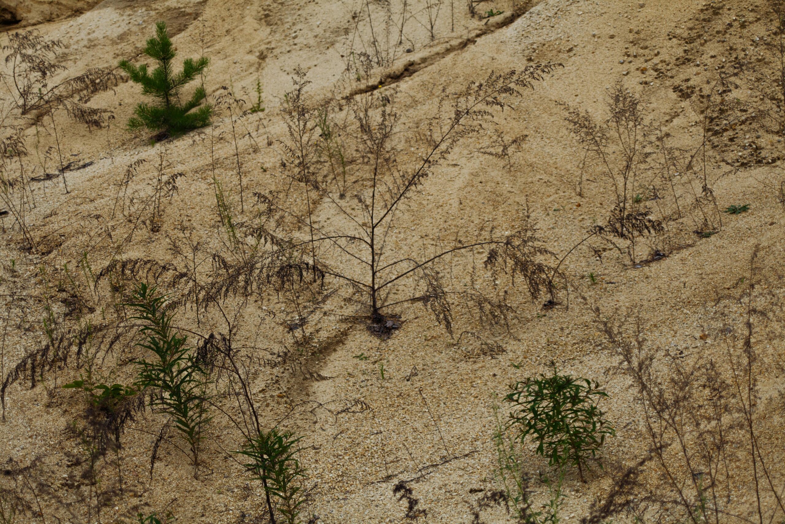
🌿 Vegetation Patterns as Environmental Indicators
Plants are nature’s most reliable informants, revealing hidden characteristics about soil, water availability, sunlight exposure, and climate patterns. Learning to read vegetation is like deciphering a detailed environmental report written by nature itself.
Plant Communities Reveal Water Sources
Lush, green vegetation in otherwise dry landscapes indicates subsurface water or springs. Species like willows, cottonwoods, alders, and cattails are reliable indicators of permanent or seasonal water sources nearby.
The density and health of vegetation correlate directly with water availability. Sparse, drought-adapted plants signal arid conditions, while thick, varied plant communities suggest consistent moisture.
Following vegetation gradients from dry-adapted species to water-loving plants can lead you directly to streams, seeps, or underground water channels—a survival skill that has saved countless lives throughout history.
Understanding Vegetation and Aspect Relationships
In the Northern Hemisphere, south-facing slopes receive more direct sunlight, creating warmer, drier conditions that support drought-tolerant species. North-facing slopes remain cooler and moister, hosting shade-loving and moisture-dependent plants.
This aspect-vegetation relationship reverses in the Southern Hemisphere, where north-facing slopes receive more sun. Understanding this principle helps you predict microclimates, find sheltered camping spots, and anticipate temperature variations.
East-facing slopes warm quickly in morning sun but cool in afternoon shade, while west-facing slopes experience afternoon heating. These subtle differences create distinct plant communities that observant terrain readers can identify.
Vegetation Height and Density Patterns
Uniform vegetation height often indicates similar age, suggesting past disturbances like fire, flooding, or human clearing. Varied heights indicate an undisturbed, mature ecosystem with complex age structures.
Vegetation density changes reveal soil depth, fertility, and drainage patterns. Dense growth indicates favorable conditions, while sparse vegetation suggests limiting factors like shallow soils, poor drainage, or nutrient deficiency.
Treeline transitions on mountains mark critical climate boundaries. The elevation where trees give way to shrubs and eventually alpine meadows indicates temperature and exposure limits that affect route planning and weather preparation.
🎨 Soil Color: Nature’s Diagnostic Tool
Soil color provides immediate visual information about mineral content, organic matter, drainage conditions, and fertility. Training your eye to interpret soil colors transforms casual observation into scientific analysis.
Decoding the Soil Color Spectrum
Dark brown to black soils indicate high organic matter content, signaling fertility and biological activity. These soils typically support productive agriculture and diverse ecosystems, formed in areas with good vegetation and moderate moisture.
Red and orange soils reveal iron oxidation (rusting), common in well-drained, older soils in warm climates. These colors indicate the soil has been exposed to oxygen and water over long periods, transforming iron minerals into rust-like compounds.
Yellow soils suggest iron compounds in different oxidation states, often found in moderately drained conditions. These soils occupy a middle ground between the extremes of waterlogged and extremely well-drained environments.
Gray and blue-gray soils signal poor drainage and low oxygen conditions (gleying). These colors indicate waterlogged soils where anaerobic conditions prevent iron oxidation, common in wetlands, floodplains, and poorly drained depressions.
White, pale, or bleached soils may indicate salt accumulation, calcium carbonate deposits, or heavily leached conditions. In arid regions, white crusts often mean salt accumulation, while in humid areas, pale soils suggest extreme nutrient loss.
Soil Color Mottling and Patterns
Mottled soils displaying mixed colors reveal fluctuating water tables. Patches of gray within brown or red soils indicate seasonal waterlogging, where some areas remain saturated while others drain periodically.
Distinct color layering in soil profiles tells erosion and deposition stories. Darker surface layers overlying lighter subsoils represent normal development, while reversed patterns may indicate past landslides, flooding, or human disturbance.
Color transitions with depth provide clues about water movement, root penetration limits, and parent material characteristics. Sharp boundaries indicate abrupt changes in conditions, while gradual transitions suggest slow, steady soil development.
🔍 Integrating Multiple Terrain Reading Skills
The true mastery of terrain reading emerges when you synthesize slope, vegetation, and soil observations into comprehensive landscape understanding. These elements interact dynamically, creating patterns that reveal the land’s history and current conditions.
Creating Your Mental Terrain Model
When entering new terrain, systematically observe slope orientation, vegetation types and patterns, exposed soil colors, and water flow evidence. These observations build a mental model predicting what lies beyond your immediate view.
Ask diagnostic questions: Why does vegetation change at this boundary? What does the soil color tell me about drainage? How does slope aspect explain the temperature difference I’m feeling? This active questioning sharpens observational skills rapidly.
Practice comparing your predictions with actual conditions as you move through terrain. This feedback loop accelerates learning and calibrates your interpretive abilities to local conditions and regional characteristics.
Seasonal Variations in Terrain Reading
Terrain characteristics change dramatically across seasons. Spring reveals water flow patterns through wet soil and swollen streams. Summer shows peak vegetation development and drought stress patterns. Autumn exposes soil through fallen leaves and reveals plant structure. Winter strips away vegetative camouflage, exposing pure topography.
Experienced terrain readers adjust their interpretation methods seasonally, recognizing that winter-dry streambeds may flood in spring, summer-green slopes may become autumn-brown, and frozen ground behaves differently than thawed soil.
Observing the same terrain across multiple seasons provides the deepest understanding, revealing temporal patterns that single-season observation cannot capture.
⚠️ Safety Applications of Terrain Reading Skills
Terrain reading abilities directly enhance outdoor safety by helping you anticipate hazards, find resources, and make informed navigation decisions.
Identifying Hazardous Terrain Signatures
Steep slopes with sparse vegetation and exposed rock signal potential rockfall zones. Fresh scars on trees and scattered rocks at slope bases confirm active hazard areas requiring cautious navigation or avoidance.
Uniform-age vegetation on slopes may indicate past landslides that cleared previous growth. These areas remain susceptible to future failures, especially after heavy rain or during snowmelt.
Gray, saturated soils on moderate slopes warn of unstable ground prone to slumping. Combined with recent precipitation, these conditions create serious hazards for trail users and campers.
Abrupt vegetation changes may indicate underlying geological boundaries, fault lines, or human-made structures like buried pipelines or old foundations that could present unexpected obstacles.
Finding Resources Through Terrain Analysis
Terrain reading skills help locate essential resources in wilderness situations. Water sources reveal themselves through vegetation patterns, slope convergence points, and soil moisture indicators.
Sheltered camping locations emerge from understanding slope aspect, wind patterns, and drainage paths. The best sites offer protection from prevailing winds, avoid drainage channels, and provide morning sun for warmth and drying.
Firewood availability connects to vegetation type and deadfall patterns. Understanding which slopes accumulate fallen timber saves energy and increases camp comfort.
📱 Technology Meets Traditional Skills
Modern apps and tools complement rather than replace terrain reading skills. Digital elevation models, satellite imagery, and GPS technology provide macro-level context that enhances ground-level observation.
Topographic map applications help you verify your terrain interpretations against mapped reality. Comparing what you observe with cartographic representations strengthens both skill sets.
Weather apps gain new significance when you understand how terrain modifies general forecasts. Your ability to predict microclimates makes weather data more personally relevant and actionable.
Plant identification apps accelerate botanical learning, helping you connect species names with the indicator characteristics you observe in the field.
🎯 Practical Exercises to Develop Your Skills
Terrain reading mastery requires consistent practice and deliberate observation. These exercises accelerate skill development regardless of your current experience level.
The Daily Observation Practice
Spend fifteen minutes daily observing a small area intensively. Notice slope variations, plant placement patterns, soil exposure points, and how these elements interact. Record observations in a journal, noting questions and hypotheses.
Return to the same spot across different weather conditions, times of day, and seasons. This longitudinal observation reveals patterns invisible during single visits and trains your eye to detect subtle changes.
The Prediction-Verification Game
Before cresting a hill or rounding a bend, predict what terrain you’ll encounter based on current observations. Will the vegetation change? Will you find water? What soil colors await?
Verify your predictions immediately and analyze discrepancies. What clues did you miss? What assumptions proved incorrect? This rapid feedback dramatically improves pattern recognition abilities.
The Photography Documentation Method
Photograph terrain features that intrigue or confuse you. Later, research the patterns you captured, consulting field guides, online resources, and local experts. Building a personal reference library of interpreted terrain photos creates a powerful learning tool.
Compare photos from different locations, identifying similar patterns and regional variations. This comparative analysis develops transferable skills applicable across diverse environments.
🌟 Transforming Your Outdoor Experience Through Terrain Literacy
Mastering terrain reading fundamentally transforms your relationship with natural environments. What once appeared as undifferentiated wilderness becomes a rich, readable landscape full of information, patterns, and meaning.
This literacy enhances every outdoor activity—hiking becomes more confident, camping more comfortable, photography more intentional, and nature observation infinitely more rewarding. You develop an almost intuitive sense of place that guides decisions and deepens appreciation.
The confidence gained through terrain reading skills reduces anxiety in unfamiliar environments. When you can read the land, you’re never truly lost—you’re simply gathering information from your surroundings.
Beyond practical benefits, terrain literacy fosters profound environmental awareness. Understanding how slope, vegetation, and soil interact reveals the elegant complexity of natural systems, inspiring conservation ethics and ecological respect.
Begin your terrain reading journey today by simply paying closer attention during your next outdoor excursion. Notice one slope characteristic, identify one vegetation pattern, observe one soil color variation. Each observation builds expertise that will serve you for a lifetime of outdoor adventures, transforming you from a casual visitor into a knowledgeable interpreter of nature’s subtle language.