
Anúncios
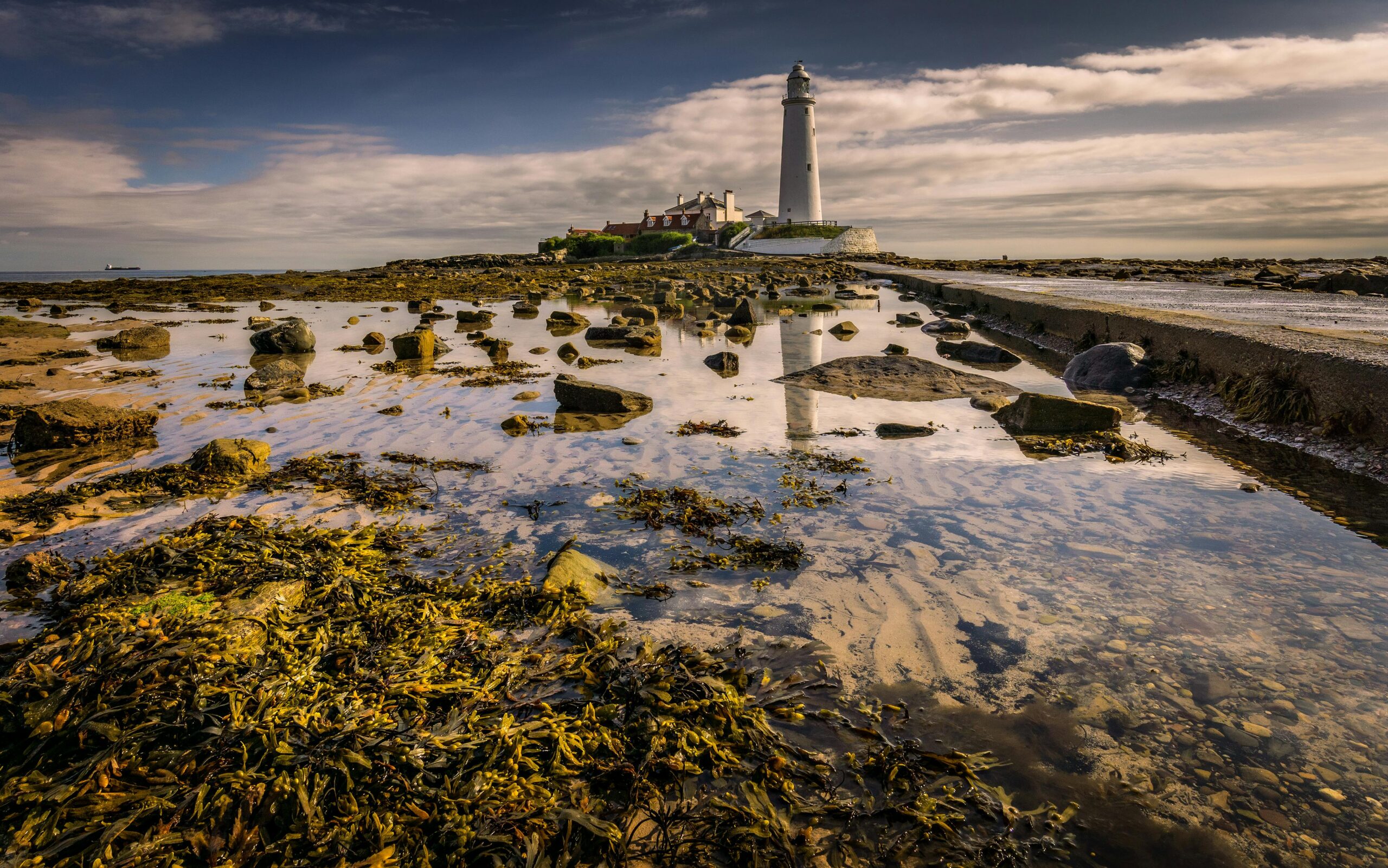
Navigating coastal waters requires more than just a compass and a map. Understanding tidal patterns can be the difference between a smooth journey and a dangerous situation at sea.
🌊 Why Tide-Timing Navigation Matters for Coastal Safety
The ocean is a dynamic environment where water levels constantly shift due to gravitational forces from the moon and sun. For anyone venturing along coastlines—whether in kayaks, sailboats, fishing vessels, or larger craft—knowing when and how tides will affect your journey is fundamental to maritime safety.
Anúncios
Tidal movements create currents that can either assist or impede your progress. A favorable tide can reduce fuel consumption, shorten travel time, and make navigation significantly easier. Conversely, fighting against a strong tidal current can exhaust resources, delay arrivals, and in worst-case scenarios, push vessels into hazardous areas such as rocks, shoals, or shallow waters.
Professional mariners have long understood that timing departures and arrivals with tidal cycles isn’t just convenient—it’s essential. This knowledge transforms potentially risky passages into manageable journeys and helps avoid the dangerous conditions that claim boats and lives each year.
Anúncios
Understanding the Fundamentals of Tidal Movement
Before you can master tide-timing navigation, you need to grasp how tides actually work. Tides are the rise and fall of sea levels caused primarily by the gravitational pull of the moon, with the sun playing a secondary role. This celestial dance creates predictable patterns that repeat approximately every 24 hours and 50 minutes.
The Tidal Cycle Explained
Most coastal areas experience two high tides and two low tides each day, known as semi-diurnal tides. The period between high and low tide typically spans about six hours and twelve minutes. Understanding this rhythm allows navigators to predict when water levels will be at their maximum and minimum.
The tidal range—the difference between high and low water—varies significantly depending on your location and the lunar phase. During spring tides, which occur during new and full moons, the range is greatest. During neap tides, occurring at the moon’s first and third quarters, the range is smallest.
How Tides Create Currents
As tides rise and fall, massive volumes of water move horizontally, creating tidal currents or streams. In narrow channels, river mouths, and between islands, these currents can reach impressive speeds—sometimes exceeding six knots in extreme locations.
The flood tide occurs as water flows toward shore and into estuaries, while the ebb tide happens as water recedes back to sea. Between these movements lies slack water—a brief period when tidal current is minimal or non-existent. This window often provides the safest time for navigating challenging passages.
⚓ Planning Your Coastal Journey Around Tidal Windows
Strategic voyage planning incorporates tidal information from the earliest stages. Successful navigators don’t simply check the tide before departure—they build entire itineraries around optimal tidal conditions.
Identifying Critical Tidal Points
Every coastal route has locations where tides matter more than others. Harbor entrances with shifting sandbars, narrow channels with strong currents, and areas with submerged obstacles all demand careful tidal consideration.
Map out your journey and identify these critical points. Research the tidal characteristics of each location, noting the times of high and low water, current speeds, and any navigational hazards that become exposed or submerged with changing water levels.
Calculating Optimal Departure Times
Working backward from your destination often proves more effective than simply leaving when convenient. If you need to cross a harbor bar that requires high water, calculate when that will occur, then determine how long your journey will take, accounting for tidal assistance or resistance along the way.
For longer passages, you might aim to catch a favorable current for the majority of your journey, accepting a brief period of adverse flow if it means benefiting from assistance during the longest leg.
Essential Tools for Tide-Timing Navigation
Modern navigators have access to resources that would astound mariners from just a generation ago. Combining traditional knowledge with contemporary technology creates the most robust approach to tidal navigation.
Tide Tables and Charts
Printed tide tables remain valuable backup resources. These publications provide predictions for high and low tides at reference stations, along with correction factors for secondary locations. Always carry current-year tide tables for your cruising area as part of your essential navigation kit.
Tidal stream atlases show current direction and speed at various stages of the tide, presented as a series of charts covering hourly intervals. These visual representations help navigators understand how currents will affect their course throughout a journey.
Digital Tide Prediction Applications
Smartphone applications have revolutionized access to tidal information. Apps like Tide Charts, Nautical Calculator, and Windy provide detailed predictions, often with graphical representations that make understanding tidal patterns intuitive.
Many navigation apps now integrate tidal data with GPS positioning, showing real-time information relevant to your exact location. This integration allows for dynamic route adjustment based on actual conditions rather than pre-departure predictions alone.
Electronic Chart Plotters and Navigation Systems
Advanced chartplotters overlay tidal current information directly onto navigational charts. These systems can calculate optimal routes that maximize favorable currents and minimize adverse flows, sometimes suggesting departure times that save hours on longer passages.
🧭 Practical Techniques for Tide-Assisted Navigation
Understanding tides theoretically is one thing; applying that knowledge practically requires experience and careful observation. These techniques help translate tidal knowledge into safer, more efficient journeys.
Reading Visual Tidal Indicators
Nature provides constant feedback about tidal conditions. Buoys leaning in the current direction, eddies behind obstacles, and the angle of moored boats all indicate current flow. Kelp beds and seaweed streaming in one direction confirm current direction and approximate strength.
Waterline marks on rocks, pilings, and harbor walls show whether the tide is rising or falling and how quickly. In areas with large tidal ranges, observing these indicators helps confirm that predictions match actual conditions.
Compensating for Tidal Set
Tidal currents push vessels sideways—a phenomenon called “set.” To maintain your intended course over ground, you must steer a heading that compensates for this lateral movement. The stronger the current, the greater the compensation needed.
Calculate the angle of compensation using vector diagrams or navigation software. Throughout your journey, monitor your course over ground using GPS, adjusting your heading as needed to account for changing current strength and direction.
Using Tidal Gates Strategically
Some passages are only safely navigable during specific tidal windows—these are called tidal gates. Rather than viewing these as obstacles, experienced navigators incorporate them into passage planning as natural rest points or schedule anchors.
If you arrive at a tidal gate too early, anchor or moor in a safe location nearby and wait for favorable conditions. Forcing passage at the wrong state of tide risks grounding, collision with obstacles, or dangerous encounters with overfalls and tide races.
Hazards That Tide-Timing Helps You Avoid
Proper tidal planning isn’t just about efficiency—it’s fundamentally about safety. Understanding how tides create or eliminate hazards enables you to navigate with confidence rather than luck.
Grounding and Shallow Water Dangers
Many coastal areas that appear navigable at high water become impassable or dangerous at low tide. Sandbars, rocky outcrops, and mudflats that lie hidden beneath a high tide can damage hulls, rudders, and propellers when water levels drop.
Always know the draft of your vessel and the predicted depth at your intended transit time. Add a safety margin to account for prediction inaccuracies, wave action, and unexpected delays that might cause you to arrive later than planned.
Strong Current Zones and Overfalls
Where tidal currents accelerate through constrictions or flow over uneven bottom topography, dangerous conditions can develop. Overfalls—areas of breaking waves and turbulence—form where strong currents meet opposing winds or flow over shallow ledges.
These conditions intensify during spring tides and can capsize small vessels or create extremely uncomfortable and potentially dangerous situations for larger boats. Timing your passage for slack water or neap tides dramatically reduces these risks.
Harbor Entrance Challenges
Many harbor entrances feature bars—shallow areas formed by sediment deposition—that present navigational challenges. Water depth over bars varies significantly with tides, and breaking waves often form when ebb currents meet incoming swells.
Crossing bars at high water slack, when depth is maximum and current minimal, represents the safest approach. Attempting bar crossings during strong ebb flows, especially with onshore swells, has led to countless maritime disasters.
🗺️ Regional Tidal Variations and Special Considerations
Tidal characteristics vary dramatically around the world. What works in one region may not apply elsewhere, making local knowledge invaluable for safe coastal navigation.
Microtidal Versus Macrotidal Environments
Some regions experience minimal tidal ranges—less than two meters—classified as microtidal. Mediterranean coasts, parts of the Caribbean, and many Pacific islands fall into this category. While tides still matter, current-related hazards are generally less extreme.
Macrotidal areas, with ranges exceeding four meters, demand much greater attention to tidal timing. The Bay of Fundy in Canada, with ranges approaching 16 meters, represents an extreme example where virtually all navigation must account for tidal conditions.
Unusual Tidal Patterns
While semi-diurnal tides are most common, some locations experience diurnal tides—just one high and one low per day. Parts of the Gulf of Mexico and Southeast Asia display this pattern. Other areas show mixed tides, with unequal high and low waters each day.
Understanding the specific tidal regime of your cruising area prevents dangerous assumptions based on experience from different regions. Always research local tidal characteristics before exploring new coastal waters.
Building Tidal Awareness Through Experience
Book knowledge provides the foundation, but developing true competence in tide-timing navigation requires practical experience. Start conservatively and progressively build skills in increasingly challenging conditions.
Starting with Familiar Waters
Begin practicing tidal navigation in local waters where you can observe patterns over multiple cycles without risk. Note how tidal predictions match reality, where currents run strongest, and how conditions change throughout the tidal cycle.
Keep a navigation journal recording tidal times, observed conditions, and how they affected your journeys. This personal database becomes increasingly valuable for future planning and develops your intuitive understanding of tidal influences.
Learning from Local Experts
Commercial fishermen, harbor masters, and experienced local sailors possess knowledge that no app or publication can fully capture. They understand subtle local effects, seasonal variations, and the exceptions to general rules that only emerge through years of observation.
Don’t hesitate to ask questions or seek advice before attempting challenging passages. Maritime communities generally welcome those who approach navigation seriously and show respect for the ocean’s power.
⛵ Advanced Tidal Navigation Strategies
Once you’ve mastered basic tide-timing, advanced techniques can further optimize your coastal journeys and unlock new cruising possibilities.
Tidal Height Calculation for Intermediate Times
Tide tables provide high and low water times, but what about depths between these extremes? The Rule of Twelfths offers a simple approximation: during each hour of a six-hour tidal cycle, the tide rises or falls by 1/12, 2/12, 3/12, 3/12, 2/12, and 1/12 of the total range respectively.
For greater precision, use tidal curve diagrams or digital calculators that account for your specific location’s tidal characteristics. This allows accurate depth predictions for any moment, enabling passage through areas with tight depth clearances.
Exploiting Tidal Eddies and Back Eddies
Along irregular coastlines, headlands, and islands, counter-currents often form in bays and behind obstructions. Skilled navigators use these eddies to make progress even when the main tidal stream is unfavorable.
This technique, called “eddy-hopping,” involves staying close to shore where back eddies run counter to the main stream, then crossing to the opposite shore before the adverse current becomes too strong. It requires careful piloting but can transform otherwise impossible passages into feasible ones.
Multi-Day Tidal Planning
Extended coastal cruises require coordinating tidal windows across multiple days and locations. Because tides shift approximately 50 minutes later each day, your optimal departure and arrival times will change daily.
Plan flexible itineraries that accommodate these shifts, identifying alternative anchorages or marinas if tidal gates don’t align favorably. Sometimes waiting an extra day allows you to catch ideal conditions for a challenging section, making the delay worthwhile for safety and comfort.
🌅 The Intersection of Tides, Weather, and Seamanship
Tidal navigation never exists in isolation. Wind, waves, weather systems, and vessel capabilities all interact with tidal conditions to determine actual safety and efficiency.
Wind Against Tide Conditions
When strong winds blow against tidal currents, sea states can deteriorate rapidly. Steep, confused waves form that are disproportionate to wind strength alone. These conditions are particularly dangerous in shallow waters and at harbor entrances.
Even moderate winds opposing a strong ebb can create hazardous conditions. Whenever possible, time passages to avoid wind-against-tide scenarios, or wait for conditions to moderate before proceeding.
Integrating Weather Forecasts with Tidal Planning
Optimal tidal windows mean little if weather makes the journey dangerous. Always check marine forecasts and consider postponing or altering plans when predictions indicate challenging conditions, regardless of favorable tides.
Sometimes accepting less-than-ideal tidal conditions allows you to travel during a weather window, making the tide-current compromise worthwhile. Developing judgment about these trade-offs comes with experience and honest assessment of your vessel’s and crew’s capabilities.
Safety Systems and Contingency Planning
Even with meticulous tidal planning, unexpected situations arise. Robust safety systems and contingency plans ensure that tidal miscalculations don’t become emergencies.
Always carry updated charts, backup tide tables, and alternative route options. Know the locations of safe anchorages where you can wait out adverse conditions. Ensure your vessel has adequate ground tackle for unexpected anchoring in various bottom types.
Communicate your plans to someone ashore, including expected arrival times and alternative destinations. If tidal conditions delay you significantly, update your shore contact to prevent unnecessary alarm or search operations.
Maintain your vessel’s engine, navigation electronics, and safety equipment in excellent condition. Tidal navigation sometimes requires precise maneuvering in challenging conditions where equipment failure could quickly escalate into serious problems.
Embracing Tidal Rhythms for Rewarding Coastal Adventures
Mastering tide-timing navigation transforms coastal journeys from stressful uncertainty into confident exploration. Rather than fighting natural forces, you learn to work with them, harnessing tidal energy to expand your cruising range while reducing risks.
This knowledge connects you more deeply with the marine environment. You begin noticing subtle signs of tidal change, understanding seasonal variations, and developing an intuitive sense of how water moves along your local coast. This awareness enriches every time you’re on the water.
The investment in learning tidal navigation pays continuous dividends—safer passages, reduced fuel costs, access to anchorages and destinations impossible to reach without tidal knowledge, and the quiet satisfaction of working skillfully with nature’s rhythms rather than against them.
Whether you’re a weekend kayaker exploring local estuaries, a coastal sailor planning multi-day cruises, or a professional mariner responsible for vessel and crew safety, tide-timing navigation represents essential seamanship. The ocean operates on its own schedule—success comes from aligning your plans with those ancient, predictable rhythms that have governed coastal waters since long before humans took to the sea.