
Anúncios
Getting lost can happen to anyone, anywhere. Whether you’re hiking remote trails, exploring unfamiliar cities, or simply taking a wrong turn, knowing how to navigate back safely is a crucial life skill that could save your life.
🧭 Understanding Why People Get Lost in the First Place
Before diving into protocols for finding your way back, it’s essential to understand the psychology and circumstances that lead people astray. Most navigation errors aren’t random—they follow predictable patterns that, once recognized, can be prevented or quickly corrected.
Anúncios
Overconfidence ranks among the top reasons people find themselves disoriented. You might think a trail looks straightforward or that you’ll remember landmarks, but unfamiliar terrain has a way of looking remarkably similar from different angles. Environmental factors like fog, darkness, or dense vegetation can transform recognizable landscapes into confusing mazes within minutes.
Distraction plays another significant role. When you’re engaged in conversation, focused on photography, or preoccupied with thoughts, your brain stops encoding directional information. Before you realize it, you’ve made several turns without conscious awareness, and retracing your steps becomes nearly impossible.
Anúncios
The Cascade Effect of Navigation Errors
One wrong turn typically doesn’t get people seriously lost—it’s the subsequent decisions made while already disoriented that compound the problem. When you first suspect you’re off course, panic can set in, triggering hurried decisions that take you further from safety rather than closer to it.
Understanding this cascade effect helps you interrupt it early. The moment uncertainty creeps in, that’s your signal to stop, assess, and implement proper protocols rather than pushing forward hoping things will “look familiar soon.”
📍 The Golden Rule: Stop as Soon as You Realize You’re Lost
This single protocol supersedes all others in importance. The instinct to keep moving, to “just go a little further,” has led to countless preventable tragedies. When disorientation sets in, continued movement without a clear plan typically worsens your situation exponentially.
Stopping immediately serves multiple critical functions. First, it prevents you from traveling further from your last known position, which search teams will use as their starting point. Second, it gives you time to calm your nervous system, which dramatically improves decision-making capacity. Third, it allows you to conserve energy and resources that might be needed later.
The S.T.O.P. Protocol Explained
Search and rescue professionals advocate for the S.T.O.P. acronym as your immediate response framework:
- Stop: Cease all forward movement the moment you suspect you’re lost
- Think: Calm yourself and recall your last known location and the route that brought you here
- Observe: Examine your surroundings for landmarks, trails, water sources, or other orientation clues
- Plan: Develop a deliberate strategy before taking any action
This methodical approach counters the panic response that clouds judgment. Taking even five minutes to work through S.T.O.P. can mean the difference between a minor inconvenience and a serious emergency.
🗺️ Essential Navigation Tools and How to Use Them Effectively
Modern technology has revolutionized navigation, but relying solely on digital devices creates vulnerability. Battery failure, signal loss, or device damage can leave you without resources precisely when you need them most. A layered approach combining traditional and modern tools provides the most reliable safety net.
Smartphone Navigation Apps and Offline Capabilities
Your smartphone is likely your most accessible navigation tool, but many people don’t realize that GPS functionality works even without cellular service. GPS satellites broadcast signals that your phone receives directly—no internet connection required.

Download offline maps before venturing into areas with limited connectivity. Apps like Google Maps allow you to select regions and save detailed maps directly to your device. This preparation takes minutes but provides hours of navigational capability without requiring signal.
Specialized hiking and outdoor navigation apps offer additional features like topographic overlays, trail databases, and waypoint marking. These tools help you track your route as you travel, creating a digital breadcrumb trail back to your starting point.
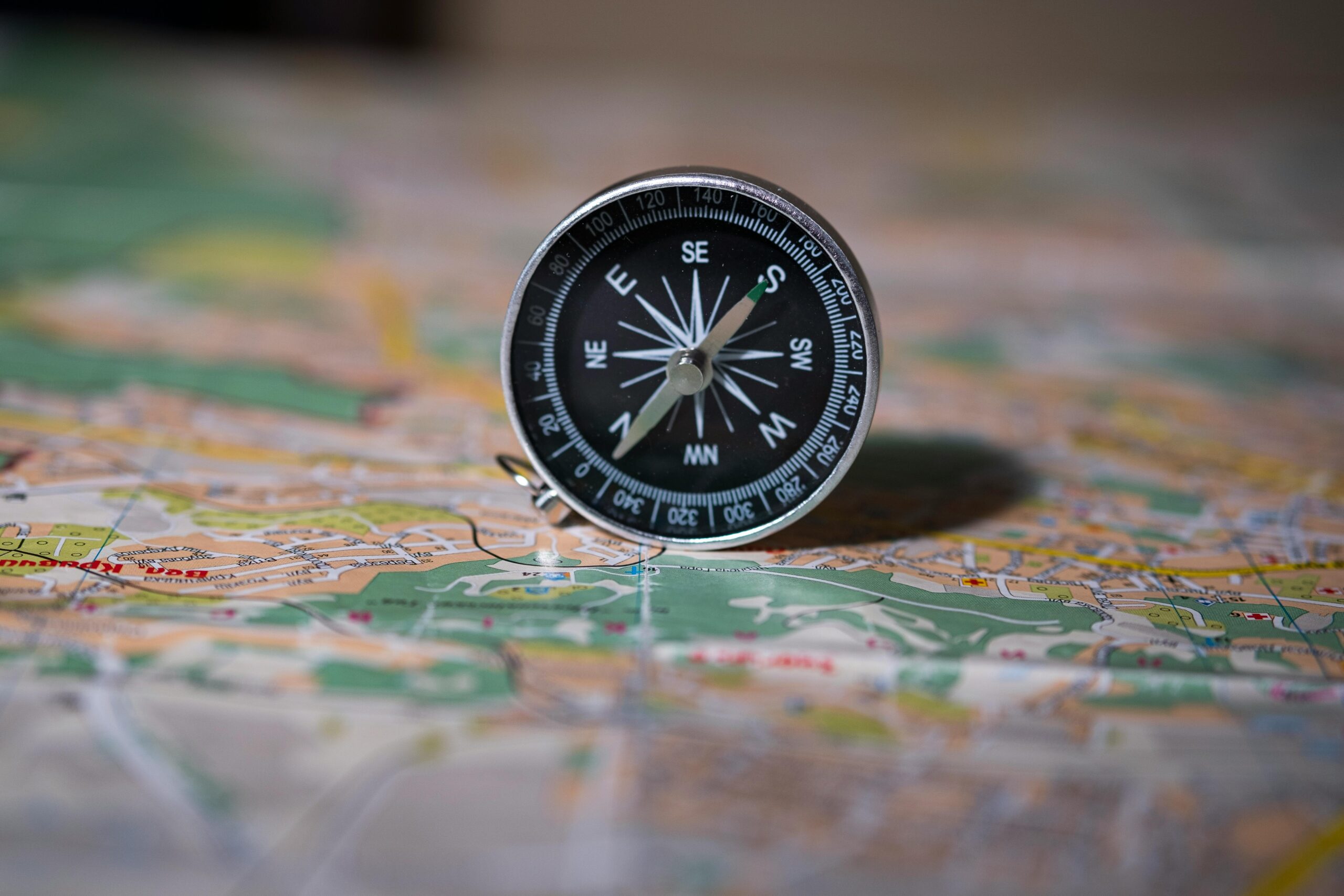
Traditional Navigation: Compass and Map Skills That Never Fail
A basic orienteering compass costs less than lunch and never needs charging. Learning fundamental compass navigation takes only an afternoon but provides lifetime value. Understanding how to shoot a bearing, triangulate your position, and follow a compass heading works in any condition, anywhere on Earth.
Physical topographic maps complement compass work by showing terrain features, elevation changes, and human-made structures. Learning to read contour lines reveals whether that hill ahead is a gentle slope or a cliff face—information that dramatically affects route planning.
🌲 Natural Navigation: Reading Nature’s Signposts
Long before compasses and GPS, humans navigated by observing natural phenomena. While these methods aren’t precision instruments, they provide valuable orientation information when technology fails or isn’t available.
Using the Sun for Directional Reference
In the Northern Hemisphere, the sun rises roughly east, reaches its highest point due south around noon, and sets roughly west. This provides a reliable east-west axis for general orientation. The shadow-stick method offers more precision: place a stick vertically in the ground, mark the shadow tip, wait 15-20 minutes, mark the new shadow tip, and draw a line between them—this line runs approximately east-west.
Reading Vegetation and Environmental Clues
Plants respond to sunlight, moisture, and prevailing winds in ways that create subtle but observable patterns. In many regions, moss grows more abundantly on the north sides of trees (though this varies with local climate). Trees often show more branch growth on sun-facing sides. Snow melts faster on south-facing slopes in the Northern Hemisphere.
Water sources provide both orientation and survival necessities. Streams flow downhill toward larger water bodies, and following water downstream typically leads toward civilization—though this journey might be long and the terrain challenging.
📱 Leveraging Technology While Maintaining Backup Plans
Smart use of technology multiplies your navigation capabilities, but technology-dependence creates vulnerability. The optimal approach integrates digital tools with traditional skills and backup systems.
Battery Management and Power Conservation
Your smartphone’s battery is your lifeline to digital navigation tools. Enable airplane mode to dramatically reduce power consumption while preserving GPS functionality. Lower screen brightness to minimum usable levels. Close unnecessary background apps that drain power without providing value.
Portable battery packs have become lightweight and affordable. A 10,000mAh power bank weighs less than six ounces but can fully recharge most smartphones twice—potentially extending your navigation capabilities for days.
Emergency Location Sharing and Check-In Protocols
Before entering remote areas, share your itinerary with reliable contacts. Include your planned route, expected return time, and emergency contact information. Several apps now offer automatic location sharing that updates your position at regular intervals when signal permits.
Establish a firm check-in time and make clear that failure to check in by that deadline means something is wrong and help should be summoned. This simple protocol has saved countless lives by triggering rescue operations before situations become critical.
🚨 When to Stay Put vs. When to Self-Rescue
One of the most difficult decisions when lost involves whether to remain in place or attempt to navigate out. Both strategies have appropriate contexts, and choosing wrongly can have serious consequences.
Situations Where Staying Put Makes Sense
If you’ve communicated your plans to someone who will notice your absence and alert authorities, staying put typically offers the best survival odds. Search teams will focus on your intended route and last known position. By remaining in one location, you’re easier to find and conserve energy and resources.
Extreme weather, approaching darkness, injury, inadequate supplies for travel, or complete disorientation all favor staying in place. In these conditions, attempting to navigate out exposes you to additional risks that outweigh potential benefits.
Circumstances That Justify Self-Rescue Attempts
If no one knows where you are or expects your return, waiting for rescue becomes problematic. Similarly, if you face immediate dangers at your current location—rising water, unstable terrain, extreme exposure—carefully planned movement might be necessary.
When you have strong confidence in your location relative to known landmarks or civilization, possess adequate supplies and physical capability, and weather and daylight permit safe travel, self-rescue becomes viable. The key is honest assessment—overconfidence has turned manageable situations into tragedies.
🧠 Managing Fear and Making Clear Decisions Under Stress
Physical navigation skills mean little if panic prevents you from applying them. Understanding how stress affects cognition and having strategies to manage fear responses is as important as knowing how to read a compass.
When your brain perceives danger, it triggers the fight-or-flight response—heart rate increases, breathing becomes shallow, fine motor control decreases, and the prefrontal cortex (responsible for complex decision-making) effectively goes offline. These physiological changes helped our ancestors survive immediate physical threats but interfere with the careful reasoning needed for navigation problem-solving.
Techniques for Restoring Calm and Clarity
Controlled breathing directly counters the stress response. Practice box breathing: inhale for four counts, hold for four, exhale for four, hold for four, repeat. This simple technique activates your parasympathetic nervous system, lowering heart rate and restoring cognitive function.
Physical action also helps—organizing your pack, eating a snack, drinking water. These mundane tasks give your mind something concrete to focus on while your nervous system recalibrates. They also ensure you’re addressing basic needs that, when neglected, amplify stress.
Positive self-talk might feel silly but measurably improves outcomes. Replace “I’m going to die out here” with “I have the skills and tools to handle this situation.” Your brain responds to the narrative you feed it, and constructive framing enhances problem-solving capacity.
🔦 Creating Visibility for Rescue Teams
If you’ve decided to stay put and wait for rescue, maximizing your visibility dramatically reduces the time searchers need to locate you. Most rescue delays occur not because teams aren’t searching but because they can’t see the person they’re looking for.
Visual Signals That Work
Bright colors contrast with natural environments. Spread out colorful clothing, tarps, or emergency blankets in open areas visible from above. Create geometric patterns—triangles, X-shapes, straight lines—which stand out as obviously human-made rather than natural features.
Mirror signals or reflective surfaces can be seen for miles by aircraft and search teams. A proper signal mirror has a sighting hole for aiming, but any reflective surface—smartphone screen, metal container lid, even polished metal—can work in bright conditions.
Audible Signals for Ground Searches
Sound carries well in many environments. Three of anything—whistle blasts, shouts, light flashes—is the international distress signal. Conserve energy by signaling at regular intervals rather than continuously. Listen carefully during quiet periods for responding signals from searchers.
Whistles require far less energy than shouting and carry much further. A simple pea-less whistle weighs almost nothing and should be standard in any outdoor kit.
🎒 Essential Items That Transform Lost Situations
Certain items disproportionately increase your safety and self-rescue capabilities when disoriented. These aren’t luxury items for wilderness expeditions—they’re practical tools that fit in any day pack and work in urban environments too.
| Item | Weight | Primary Use When Lost |
|---|---|---|
| Whistle | 0.5 oz | Audible signaling without energy expenditure |
| Emergency blanket | 2 oz | Warmth retention and visual signaling |
| Headlamp with extra batteries | 3 oz | Navigation after dark and light signals |
| Compass | 1 oz | Directional orientation without batteries |
| Water purification tablets | 2 oz | Safe hydration from natural sources |
| Fire starter | 1 oz | Warmth, signaling, and morale |
| Portable battery pack | 6 oz | Extended smartphone/GPS functionality |
Notice that these seven items total less than one pound but collectively address the most critical needs when disoriented: signaling, navigation, shelter, hydration, and communication. Their small size and weight make them practical for any outing, not just dedicated wilderness trips.
🏔️ Terrain-Specific Navigation Strategies
Different environments present unique challenges and opportunities. Adapting your approach to the specific terrain significantly improves navigation success.
Forest Navigation Challenges and Solutions
Dense vegetation obscures distant landmarks and creates visual similarity that confuses spatial memory. Combat this by making deliberate observations at decision points—photograph trail junctions, note distinctive trees or rock formations, use mapping apps to drop waypoint pins.
Following ridge lines generally provides easier travel than valley bottoms and offers better visibility. However, ridges can peter out into cliffs or impassable terrain, so advance carefully with frequent position checks.
Desert and Open Terrain Considerations
The opposite problem occurs in deserts—distances deceive because clear air and lack of reference points make destinations appear closer than they are. What looks like a one-hour walk might be three hours or more. Conserve water and energy by making realistic distance assessments.
Heat management becomes critical. Travel during cooler morning and evening hours when possible, rest in shade during peak heat, and prioritize hydration above almost everything else.
Urban Disorientation and City Navigation
Getting lost in cities happens more often than wilderness disorientation. Unfamiliar neighborhoods, similar-looking buildings, and the maze-like quality of urban layouts confuse even experienced travelers.
Major landmarks—tall buildings, monuments, transit stations—provide reference points. Most cities follow some grid or logical street pattern that, once recognized, aids navigation. Don’t hesitate to ask locals for directions; most people gladly help disoriented visitors.
💪 Building Navigation Confidence Through Practice
Reading about navigation provides knowledge, but confidence comes only through practice. Regular skill-building in controlled environments prepares you for genuine emergencies.
Start with low-stakes practice sessions. Navigate familiar parks using only compass and map, deliberately taking complex routes to challenge yourself. Try natural navigation exercises—estimate cardinal directions using sun position, then verify with a compass. These exercises reveal knowledge gaps while consequences remain minimal.
Gradually increase difficulty by exploring less familiar areas, practicing in varied weather conditions, and introducing constraints like navigating without GPS. Each successful exercise builds competence and, more importantly, confidence in your ability to handle disorientation.
Consider taking formal navigation courses from outdoor recreation organizations, community colleges, or search and rescue groups. Structured instruction accelerates learning and exposes you to techniques you might not discover independently.
🌟 Transforming Lost Episodes Into Learning Experiences
Even with excellent skills and preparation, occasional disorientation is nearly inevitable if you regularly explore new places. Rather than viewing these moments as failures, treat them as valuable learning opportunities that refine your capabilities.
After any navigation challenge, conduct an honest after-action review. What were the first signs you were off course? What worked well in your response? What would you do differently next time? This reflection converts experience into wisdom.
Share your experiences with others. Navigation stories normalize the reality that getting temporarily lost happens to everyone and spreads practical knowledge about what works in real situations versus what sounds good in theory.
Most importantly, don’t let fear of getting lost prevent you from exploring. Calculated risk-taking—venturing into new places while equipped with proper skills, tools, and protocols—leads to some of life’s most rewarding experiences. The goal isn’t to eliminate all possibility of disorientation but to ensure that when it happens, you possess the knowledge and confidence to handle it safely and effectively.