
Anúncios
The shoreline holds ancient secrets written in stone, tide, and time—secrets that skilled fisherfolk have decoded for generations to find the richest fishing grounds.
Every coastal rock formation tells a story. The weathered surfaces, distinctive color patterns, and mysterious tide marks aren’t random features—they’re nature’s signposts pointing toward productive fishing spots, safe anchorage, and abundant marine life. For those who learn to read these coastal codes, the shoreline transforms from a simple boundary between land and sea into a detailed map of underwater treasures.
Anúncios
Understanding these natural markers can mean the difference between returning home with empty nets or celebrating a bountiful catch. Traditional fishing communities worldwide have passed down this knowledge through countless generations, developing sophisticated systems for interpreting coastal geology, tidal patterns, and environmental indicators that modern science is only beginning to fully appreciate.
🪨 Decoding Rock Formations Along the Coast
Rock shapes along the shoreline aren’t merely aesthetic features—they’re geological fingerprints that reveal critical information about underwater topography, current patterns, and fish behavior. Experienced fisherfolk know that certain rock formations consistently produce better fishing results than others.
Anúncios
Angular, jagged rocks typically indicate recent geological activity or strong wave action. These formations often create turbulent water zones where smaller fish seek shelter and larger predators come to hunt. The crevices and caves formed by fractured rock provide essential habitat for crustaceans, mollusks, and juvenile fish, creating a complete food chain in a relatively small area.
Smooth, rounded boulders tell a different story entirely. These stones have endured centuries of wave action, gradually worn down by the relentless rhythm of tides. Their presence suggests consistent water flow patterns and stable environmental conditions—factors that encourage permanent fish populations rather than transient visitors.
Flat, layered rock formations known as sedimentary shelves create natural platforms that extend underwater, forming ledges where fish congregate. These underwater shelves act as highways for migrating species and hunting grounds for ambush predators. Fisherfolk who identify these formations from their surface characteristics can position themselves strategically for maximum success.
Volcanic vs. Sedimentary: Reading the Geological Story
The fundamental rock type determines much about the local marine ecosystem. Volcanic rocks, darker in appearance and often porous, create entirely different habitats compared to sedimentary formations. Basalt and other igneous rocks feature numerous small holes and pockets where marine organisms establish themselves, creating dense biological communities.
Sedimentary rocks like limestone and sandstone erode more predictably, forming caves, overhangs, and tunnel systems that larger fish species prefer. These formations also affect water chemistry—limestone gradually dissolves in seawater, slightly raising pH levels and creating conditions that certain species find particularly attractive.
🎨 The Language of Color Bands
Color variations on coastal rocks aren’t simply geological curiosities—they’re practical indicators that reveal tidal ranges, water quality, biological activity, and seasonal patterns. Learning to interpret these natural color codes transforms casual observation into actionable fishing intelligence.
The most obvious color band appears at the high tide mark, where marine organisms and mineral deposits create a distinct line around rocks. This boundary zone typically shows darker coloration from algae, barnacles, and other intertidal species that can survive both submersion and exposure to air.
Below this primary band, successive color layers reveal the frequency and duration of tidal coverage. Bright green patches indicate areas regularly exposed to sunlight during low tides—zones where photosynthetic organisms thrive. These areas attract herbivorous fish species and the predators that hunt them.
Orange and rust-colored bands signal iron oxidation, common in areas with specific mineral content or freshwater seepage. These zones often attract unique species adapted to slightly different water chemistry, offering opportunities for specialized fishing techniques.
Seasonal Color Shifts and What They Mean
Experienced fisherfolk monitor how color bands change throughout the year. Spring blooms create vivid green zones as algae populations explode with increased sunlight and nutrients. Summer bleaching occurs in high-exposure areas, creating lighter bands where intense sun and heat stress marine organisms.
Autumn brings darker, richer colors as cooler waters support different species compositions. Winter storms strip away seasonal growth, revealing the underlying rock and allowing observation of long-term geological features masked during other seasons.
These color transitions don’t just indicate seasonal change—they signal shifts in fish behavior, feeding patterns, and optimal fishing locations. Smart anglers adjust their strategies as the coastal palette transforms.
🌊 Tide Mark Mysteries Unveiled
Tide marks represent one of the most valuable yet often overlooked sources of fishing intelligence. These natural indicators reveal not just where water reaches, but how it moves, what it carries, and where fish are likely to concentrate.
The primary high tide mark appears as a distinct line of debris, biological material, and color change. However, multiple tide marks often exist, each corresponding to different tidal conditions—spring tides, neap tides, storm surges, and seasonal variations all leave their signatures.
Fresh tide marks show recent water activity. Wet areas, displaced stones, and newly deposited organic material indicate the last high tide’s reach. Examining what the tide brought in provides clues about current offshore conditions—certain seaweeds indicate productive fishing zones offshore, while specific shells suggest abundant populations of particular species.
Old, established tide marks show long-term patterns. Permanent staining, deeply embedded barnacle colonies, and worn rock surfaces at specific elevations reveal the normal tidal range and help predict where water will reach under various conditions.
Reading Tide Pools Like Underwater Windows
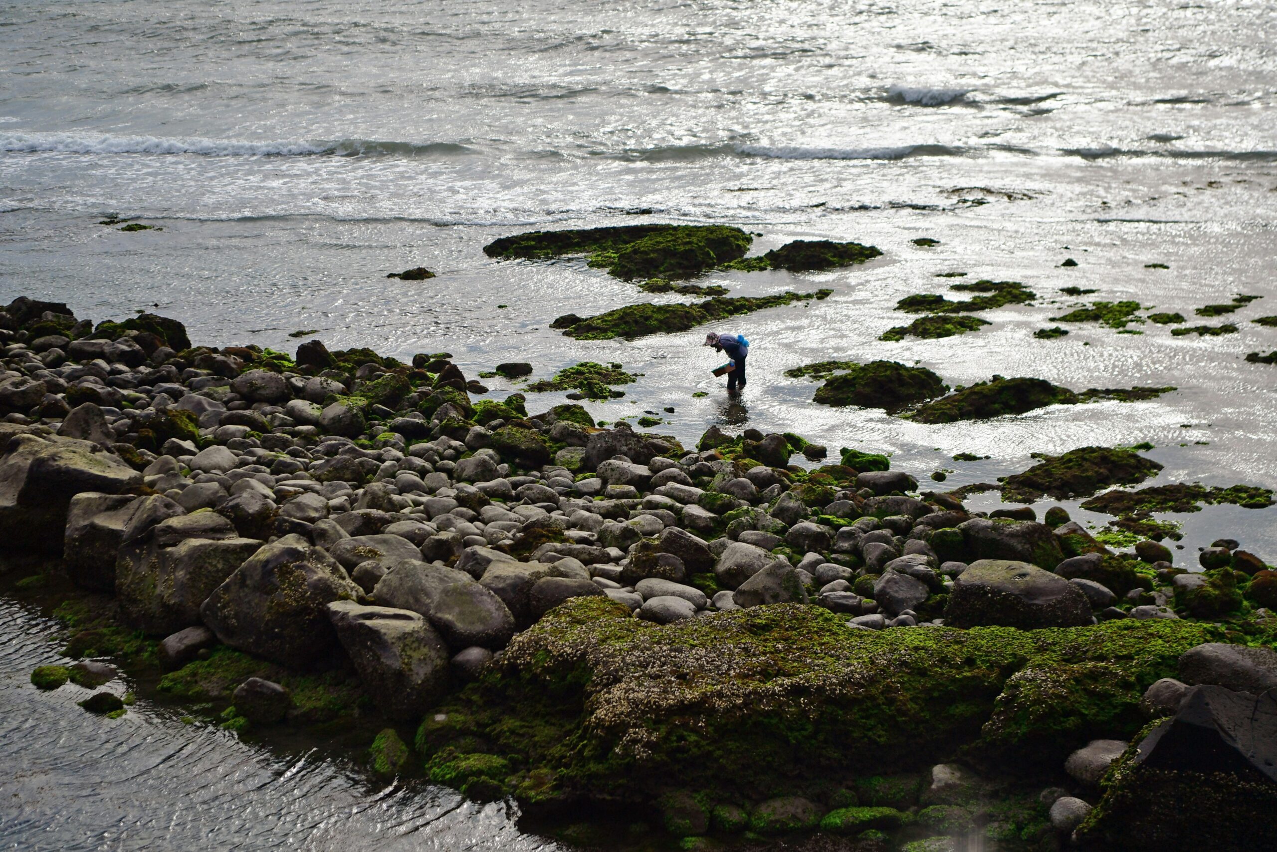
Tide pools function as natural aquariums, offering direct observation of local marine life without specialized equipment. The species present in these pools indicate what lives in adjacent deeper waters. A tide pool teeming with small crabs and shrimp suggests nearby populations of fish that feed on these creatures.
Water clarity in tide pools signals overall water quality. Crystal-clear pools indicate clean, well-oxygenated water—conditions that support diverse fish populations. Cloudy or discolored pools may indicate pollution, excessive sediment, or algae blooms that affect fishing success.
Temperature variations between pools provide micro-climate information. Pools retaining cooler water even during low tide suggest underground springs or consistent water circulation—features that attract fish seeking temperature refuge during extreme weather.
⚓ Connecting Rock Features to Fish Behavior
Understanding geological features means little without connecting them to actual fish behavior. The most productive fisherfolk think like fish, using shoreline clues to predict where species will feed, rest, and migrate.
Structure-oriented species like grouper, snapper, and sea bass gravitate toward complex rock formations with caves, overhangs, and crevices. Identifying these features from shore allows targeted fishing that dramatically increases success rates.
Current-dependent species position themselves where water flow concentrates food sources. Rock formations that create eddies, upwellings, or convergence zones become natural feeding stations. Surface water patterns around visible rocks reveal these underwater dynamics—smooth water behind rocks indicates shelter zones, while choppy, disturbed water suggests strong currents bringing nutrients and prey.
Ambush predators prefer transition zones where different rock types meet, creating environmental edges. A boundary between smooth boulders and jagged volcanic rock offers varied habitat in close proximity, concentrating diverse prey species and the hunters that pursue them.
Seasonal Migration Patterns Written in Stone
Coastal rock formations channel fish migrations in predictable ways. Headlands, points, and underwater ridges extending from shore create natural highways that migrating species follow. Observing above-water rock formations helps identify these underwater structures.
Spring migrations typically move fish closer to shore as warming water and abundant food draw them into shallower zones. Rock formations that create protected areas with gradual depth changes attract spawning aggregations of numerous species.
Fall migrations reverse this pattern, but fish concentrate near specific structures that offer staging areas before moving to deeper winter grounds. Learning which rock formations serve these purposes transforms good fishing spots into exceptional ones.
🧭 Traditional Knowledge Meets Modern Understanding
Indigenous and traditional fishing communities developed sophisticated systems for reading coastal features long before modern science explained the underlying principles. This accumulated wisdom offers practical insights that complement contemporary marine biology and oceanography.
Many cultures named specific rock formations, passing down knowledge about their fishing potential through oral traditions. These names often encoded practical information—”the rock where grouper spawn at full moon” or “the stone that shows the king tide” conveyed precise, actionable intelligence.
Traditional observation methods included monitoring bird behavior around coastal rocks. Seabirds diving consistently near specific formations indicated baitfish concentrations, which in turn suggested predatory fish below. This natural fish-finder required no technology beyond patient observation.
Modern fish-finding technology and GPS mapping now allow documentation and sharing of this traditional knowledge. However, the fundamental skills of observation, interpretation, and pattern recognition remain essential. Technology enhances but doesn’t replace the trained eye that reads shoreline secrets.
🔍 Practical Application: Building Your Observation Skills
Developing the ability to read coastal features requires systematic practice and patient observation. The following approach helps build comprehensive shoreline literacy:
- Visit the same coastal section during different tidal stages, documenting how water levels interact with rock formations
- Photograph color bands and tide marks monthly to track seasonal changes and identify patterns
- Record fishing success relative to specific rock features, building a personal database of productive locations
- Compare your observations with weather conditions, moon phases, and seasonal patterns
- Study local geology to understand the rock types in your area and their specific characteristics
- Consult with experienced local fisherfolk who possess generational knowledge about specific locations
Creating a simple observation journal accelerates learning. Note rock shapes, colors, tide marks, and corresponding fishing results. Over time, patterns emerge that transform random observations into predictive intelligence.
Safety Considerations When Reading the Shore
Enthusiastic shoreline observation can lead to dangerous situations if proper precautions aren’t observed. Rocky coastlines present specific hazards that demand respect and awareness.
Always monitor tide times before exploring intertidal zones. Incoming tides can trap unwary observers against cliffs or on isolated rocks. Understanding tide marks includes recognizing how quickly water can rise and which areas become cut off during flood tides.
Wet rocks develop extremely slippery surfaces, especially those covered with algae or moss. The same biological indicators that reveal tidal patterns also create treacherous footing. Appropriate footwear with excellent traction is essential, not optional.
Rogue waves strike without warning, particularly during storms or high surf conditions. Even calm-looking seas can generate occasional large waves that sweep across rocks. Maintain awareness of the ocean, never turning your back on incoming waves for extended periods.
🌅 Optimal Times for Shoreline Observation
Different times and conditions reveal different aspects of coastal features. Strategic timing maximizes learning and fishing success.
Extreme low tides expose normally submerged features, allowing observation of underwater rock formations, reef structures, and benthic communities. Spring tides occurring during new and full moons create the lowest lows and highest highs, offering exceptional observation opportunities.
Dawn and dusk provide optimal lighting for photographing and observing color bands. The low angle of sunlight emphasizes subtle color variations and textural differences that harsh midday light washes out. These times also coincide with peak fish feeding activity, allowing direct correlation between geological features and fish presence.
Post-storm conditions reveal dramatic changes in coastal features. Storms redistribute sand, expose buried rocks, and create new channels. Observing these changes helps predict how storms affect fishing patterns and where fish relocate after significant weather events.
📚 Deepening Your Coastal Literacy
Shoreline observation skills improve continuously with dedicated practice and study. Beyond direct observation, several resources accelerate learning and deepen understanding.
Geological survey maps reveal rock types and formations in your area, providing scientific context for field observations. Understanding whether you’re looking at granite, basalt, limestone, or sandstone explains why certain features appear and what marine life they support.
Tide prediction tables and apps help plan observation sessions and correlate tidal stages with specific features. Understanding tidal coefficients, lunar influences, and seasonal variations in tidal range transforms basic tide awareness into sophisticated predictive capability.
Marine biology field guides connect observed creatures in tide pools and on rocks with broader ecosystem patterns. Identifying barnacle species, algae types, and invertebrate populations provides indirect information about water conditions, temperature, and the fish species likely present.
🎣 From Observation to Action: Applied Fishing Strategies
Reading shoreline secrets only matters if that knowledge translates into fishing success. The following strategies connect observation with practical application.
When color bands indicate recent tidal activity and abundant algae growth, target herbivorous species and their predators. Fish feeding on algae-grazing invertebrates concentrate in these zones during specific tidal stages.
Rock formations creating visible water disturbance signal current breaks and eddy zones. Position yourself upstream of these features during incoming tides when fish face into current watching for food, or downstream during outgoing tides when prey gets swept from protected areas.
Multiple tide marks at different elevations indicate variable water levels. During spring tides, fish higher zones than during neap tides. Species adapted to different depths occupy different elevation bands as tidal ranges change.
Fresh debris at high tide marks signals recent storm activity or unusual water movement. Fish often feed aggressively on displaced organisms, making post-storm periods at high tide marks particularly productive.
🌍 Regional Variations in Coastal Features
Coastal characteristics vary dramatically between regions, requiring adaptation of observation techniques to local conditions. What works on rocky Pacific coastlines differs from Atlantic shores, tropical reefs, or polar regions.
Tropical coastlines often feature coral formations rather than rock, requiring different interpretation methods. Color bands on coral reflect different biological processes than those on temperate zone rocks, though the principle of reading environmental indicators remains constant.
Extreme tidal ranges in areas like the Bay of Fundy create dramatically different observation opportunities compared to minimal-tide regions like the Mediterranean. Learning your local tidal characteristics is fundamental to effective shoreline reading.
Volcanic coastlines like Hawaii or Iceland present darker rocks with different weathering patterns than sedimentary shores of the Caribbean or Mediterranean. Each geology type requires calibrated observation skills specific to its characteristics.
🔮 Predicting Future Conditions From Present Signs
Master-level shoreline observation includes predictive capability—using current indicators to forecast future fishing conditions. This skill separates exceptional fisherfolk from merely competent ones.
Observing how quickly algae colonizes rocks after storms predicts ecosystem recovery timing. Rapidly returning green color bands suggest resilient, productive environments where fish populations recover quickly. Slow recolonization indicates stressed ecosystems requiring more time before fishing normalizes.
Monitoring barnacle settlement patterns forecasts water quality trends. Abundant young barnacles indicate good water conditions and plankton availability—conditions supporting robust fish populations. Sparse settlement or dying barnacle colonies warn of degraded conditions.
Tracking seasonal color band progression helps predict optimal fishing windows. When color patterns match previous years’ successful periods, current conditions likely favor similar fishing success.
The shoreline speaks to those patient enough to listen and observant enough to understand its language. Rock shapes reveal underwater structure, color bands indicate biological productivity, and tide marks show water movement patterns—together creating a comprehensive guide to fishing success. This ancient knowledge, refined through generations and enhanced by modern understanding, transforms casual shore walking into sophisticated environmental reading. Every coastal visit becomes an opportunity to decode nature’s signals and locate abundant fishing grounds. The secrets are there, written plainly in stone, color, and tide for those who learn to read them. 🌊